As you begin to plan your summer vacation in the months ahead (yes, we like to plan waaaaaay ahead!), we thought we should share a gem of a drive that we spent many miles on this past spring, summer, and fall. The Beartooth Highway in Montana and Wyoming
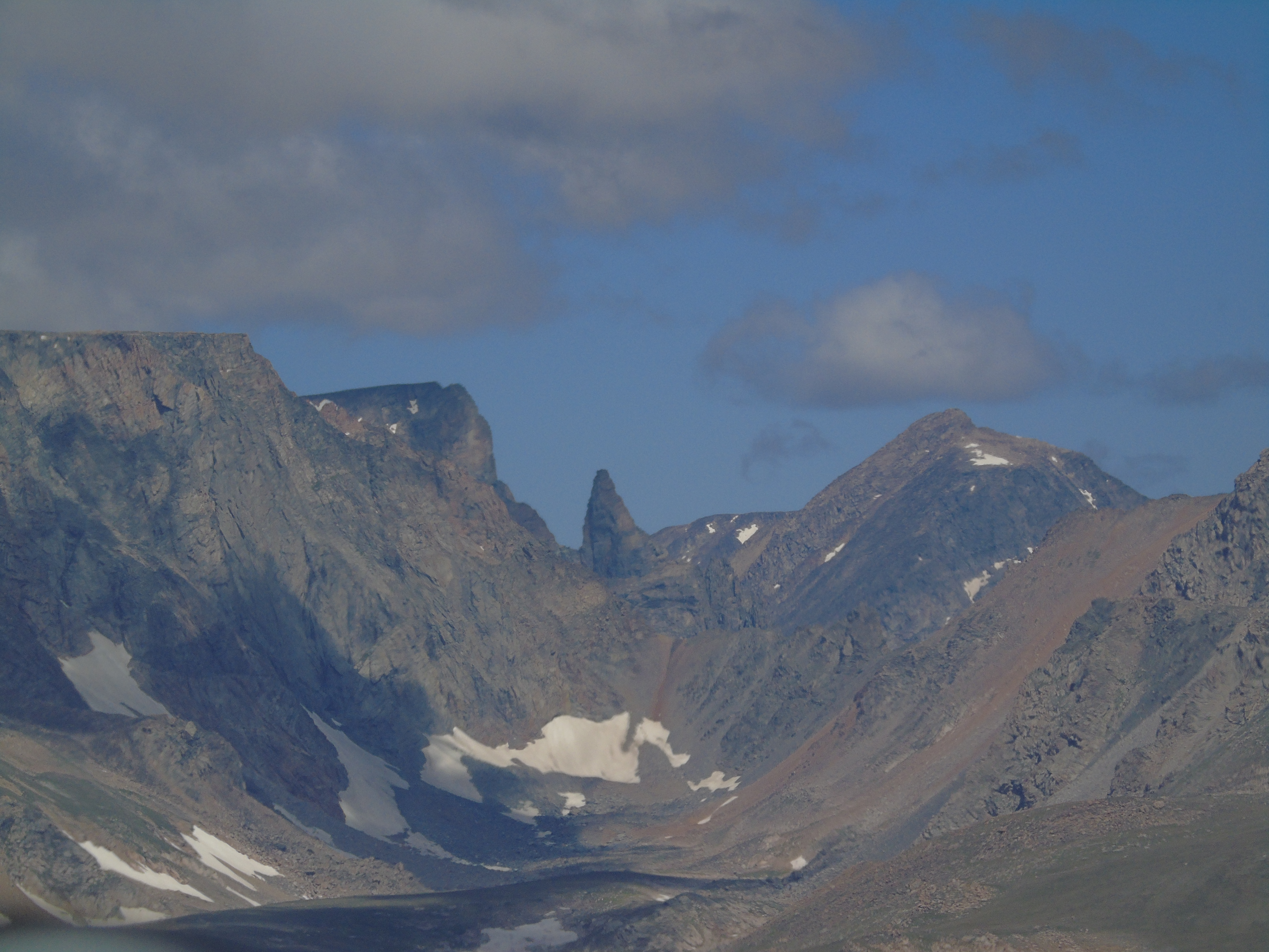
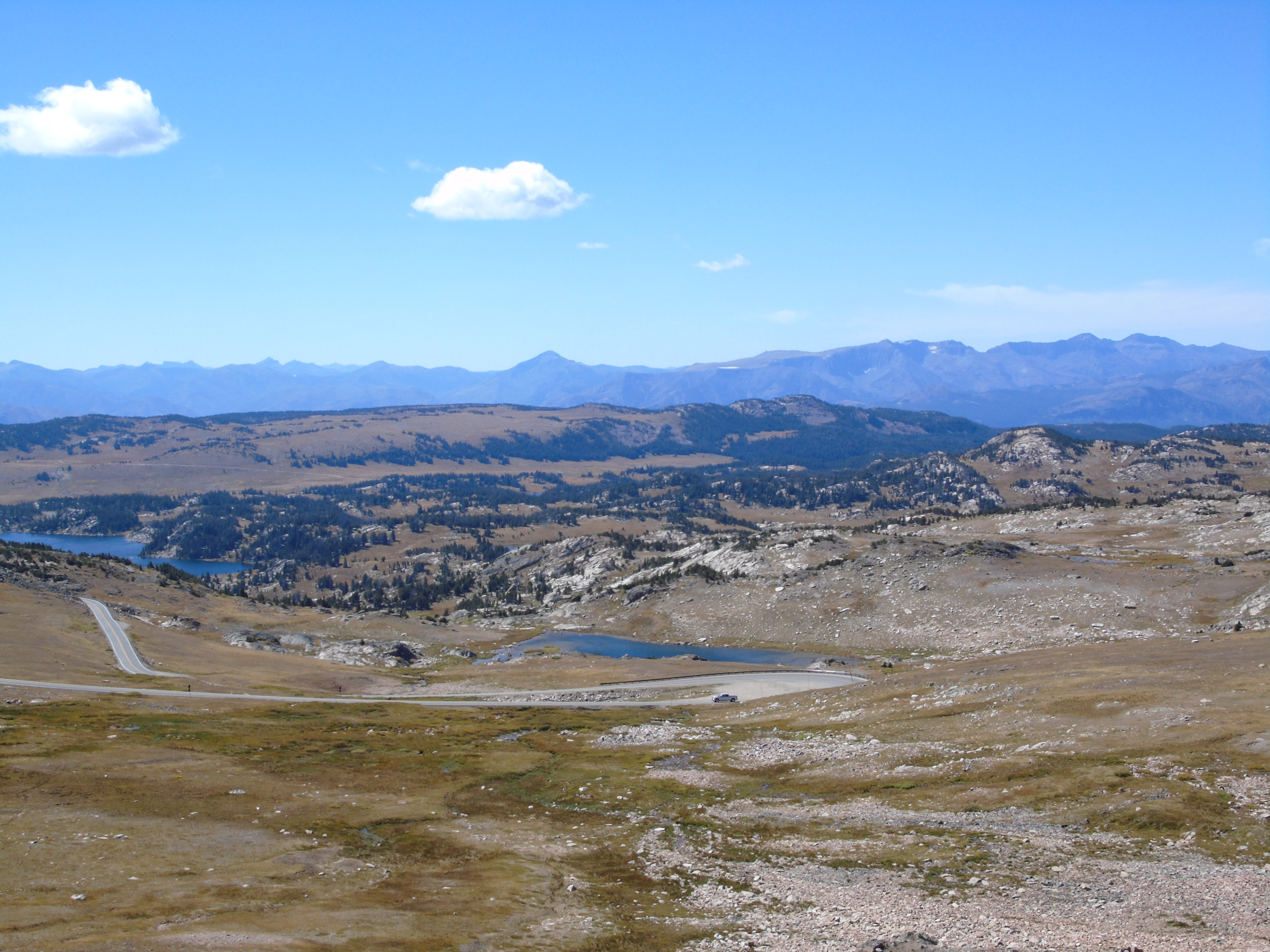
is perhaps the most scenic route to get to Yellowstone National Park, from Red Lodge to Cooke City, MT, and definitely the HIGHEST route to get there! At 10,977 feet above sea level, the peaks around the top of the Beartooth Pass are usually covered with glacial snows any time of year.
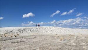
Our first trip on the highway was during opening week in May 2015, just after Memorial Day. We were staying in Red Lodge for the week at a nice little time share (another blog post review coming!) and had booked a night in the Dunraven Lodge in the Canyon area, so we could spend a few days in Yellowstone National Park. As we rose in elevation along the highway, the snowbanks along the side of the road got taller, and our son, Calvin, saw where people had stopped to carve their name in the snow. Since there was no one behind us for miles, we pulled over at a turn-out and let him put his name out there, too!
Our high point of traveling on this highway has to be the Rock Creek Vista Point, where you can pull out for an amazing panoramic view of the glacial Beartooth Mountains. The restrooms at this point never ceased to be the cleanest we encountered on our trips, and due to the elevation and constant breeze at the point, also the least smelly ones! If you have a few snacks in your car, you might want to accidentally drop a few for the incredibly friendly chipmunks and ground squirrels that case the area looking for freebies. Some are more well-fed than others, but most will come right up to you.
Daring tourists may be willing to allow them to climb up on their hands or legs (not us!). And for the record, they don’t care for processed snacks, but prefer nuts, such as pistachios… at least that’s what we’ve heard. *wink*
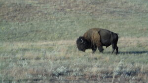
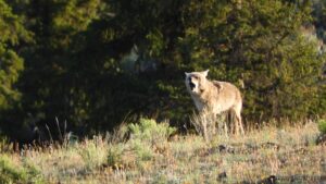
As you descend toward the west side of the pass, be sure to watch for marmots among the rocks, and keep an eye out for mountain goats, elk, and moose! Although we never got to
see a bear along the pass, several people we know have seen them near the high-elevation lakes, Beartooth and Island Lakes. Since the pass traverses through three National Forest areas – Gallatin, Shoshone, and Custer – there are also many NFS campground and backcountry camping opportunities along the route. However, stick to hard-sided campers as this is grizzly country!
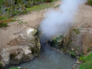
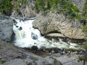
Be sure to take advantage of all the pull-outs along the highway. There are scenic vistas, hidden waterfalls, the Bear’s Tooth Peak (approx. 14,000 ft in elevation), and amazing wildflower meadows. There are nice trails to hike (or cross-country ski) down to glacial lakes and streams,
some that dry out by early fall. Each season highlights an amazing part of this ecosystem! Spring – watch for vernal waterfalls along the roads from snow melting off the glaciers. Summer – the wildflowers in July are just simply amazing. Great photo opportunities as the land “greens up” and brings in more wildlife than any other season. Fall – the oranges and browns of fall offset the blue skies and dark lakes, contrasting with the remaining glaciers on nearby peaks.

We ended up traversing the Beartooth Highway seven times in 2015, three times with our small trailer RV being pulled behind – once with our Subaru and twice with our Durango. We recommend being sure your vehicles are in top shape, and that you are not at your towing limit for your vehicle before embarking on this road! Our Subaru ran great, but it was slow going since we are at the top of its towing class with our camper. Also, there is very intermittent cell phone service along the pass, so in the event of vehicle trouble, you may have to wait for a while for another tourist to pass, be willing to stop to help, and for them to get to a town or cell service before help can arrive! Also, Cooke City, at the time of our last pass-through in September, did not have cell phone service available at all. Be prepared!

Beartooth Highway is a seasonal road that is open from around Memorial Day to mid-October. The weather at the top can change frequently, so it is always best to check with the nearby towns to see if the pass is open during your visit. Bring layers with you in the car – stopping near or at the top of the pass is very cold and breezy – even in July!
For hikers, be sure to have sunscreen in any season, as the altitude will lend itself to fast sunburn, especially on your face. The best part of traveling the Beartooth Highway, is that it is never the same experience twice! Weather, temperatures, wildlife, and fellow tourists all make the experience unique every time. Most of all, be sure to include this memorable route in your plans for travels this year!
You can find much more information and maps for the Beartooth Highway at their website: http://beartoothhighway.com.